

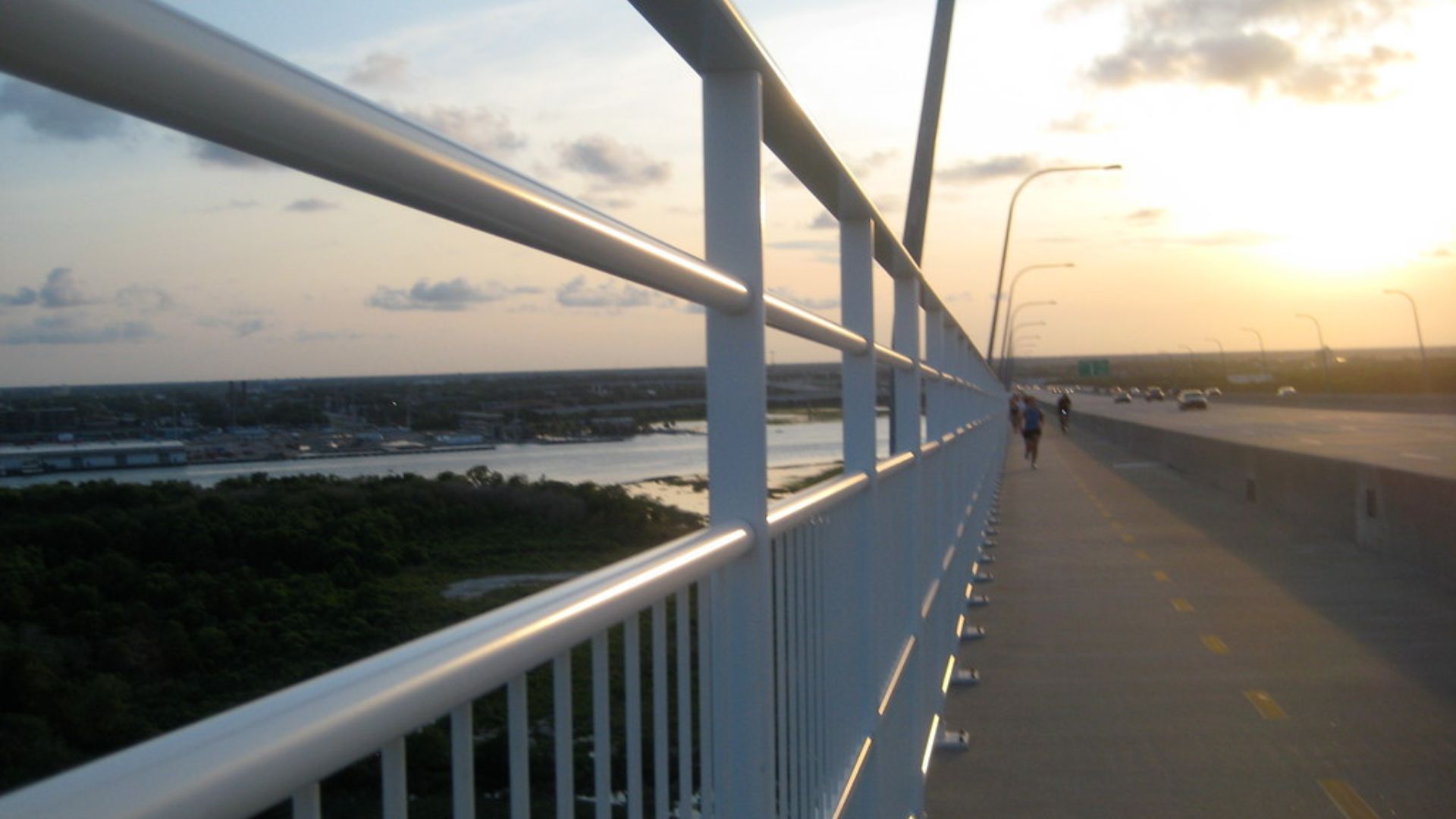
The ravenel bridge walking path in Charleston, South Carolina is one of the most popular free outdoor activities in the city.
I have walked it multiple times across different seasons, and it genuinely never gets old. The views, the wind, the climb to the top. It all hits differently depending on when you go.
If you are planning your first visit, you probably want to know where to park, how hard it is, what to bring, and what most people get wrong. I cover all of that here.
I have been writing about U.S. outdoor travel destinations for years and have walked this path in spring, summer, and fall. You are in the right place.
What Is the Ravenel Bridge Walking Path?
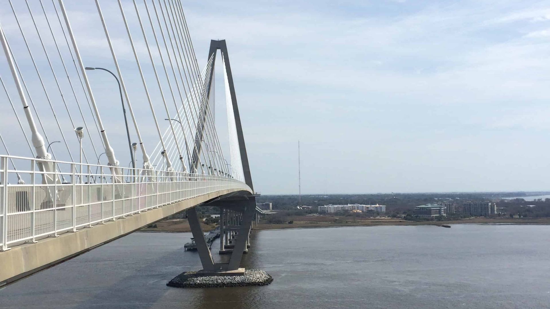
The Arthur Ravenel Jr. Bridge is a cable-stayed bridge in Charleston, South Carolina, and one of the longest of its kind in North America.
What most people do not realize is that it has a dedicated pedestrian and cycling lane running its full length.
The ravenel bridge walking path sits on the east side of the bridge, separated from car traffic by a solid barrier.
You walk directly over the Cooper River with open water on both sides. No entry fee. No permit. No reservation.
It is not a hiking trail. It is a paved, well-maintained path that works for walkers, joggers, cyclists, and anyone in between.
Ravenel Bridge Walking Path Distance and Layout
The Arthur Ravenel Jr. Bridge walking path covers about 2.5 miles one way. A full round trip puts you at roughly 5 miles total.
The path rises gradually as you move toward the main cable towers. The highest point sits about 186 feet above the Cooper River. That center section offers the most striking views, both toward the harbor and back toward the Charleston skyline.
The surface is smooth and paved the entire way. Lane markings separate pedestrians from cyclists, which keeps things organized and safer than many people expect before their first visit.
Where to Start: Ravenel Bridge Walking Path Parking Guide

Knowing where to park before you arrive saves you a frustrating loop around the area, especially on busy weekends.
Mount Pleasant Side (Preferred Starting Point)
Most people start here, and I think it is the smarter choice. Free parking is available near the base of the bridge off Coleman Boulevard. The lot fills up on weekends, so arriving before 8 a.m. gives you the best shot at a spot.
The trailhead is clearly marked from the parking area. You will not miss it.
Charleston Side
Starting from the Charleston side is possible, but parking is limited. Street parking is available but gets competitive fast. If you are staying in downtown Charleston, walking over from your hotel is actually a clean option that skips the parking problem entirely.
What to Expect on the Ravenel Bridge Pedestrian Path
The first thing that hits you on the Ravenel Bridge pedestrian path is the wind. Once you get above the water, it picks up quickly. On certain days, it pushes hard enough to make you shift your footing.
The climb toward the towers is gradual but real. You will feel it in your legs by the top if you are not used to inclines.
The views from the peak are impressive in a way that is hard to describe at street level. The Charleston skyline sits on one side. Open water stretches toward the harbor on the other. Cargo ships pass below you.
Foot traffic varies a lot. Weekday mornings are calm. Weekend afternoons bring out families, runners, tourists, and cyclists in large numbers.
Best Time to Walk the Ravenel Bridge Walking Path
Early morning is consistently the best time. Crowds are thin, temperatures are manageable, and the light on the water is worth waking up early for.
Spring and fall are the most comfortable seasons overall. Summer in Charleston is hot and humid, which makes midday walks genuinely unpleasant. Go before 8 a.m. or after 6 p.m. if you visit in summer.
Sunset is a strong option if photos are the goal. The colors over the Cooper River during golden hour are hard to beat.
Avoid holiday weekends if a quieter experience is what you are after.
Wind Conditions by Month
Wind on the Arthur Ravenel Jr. Bridge varies more than most visitors expect.
January through March: Cold and windy. Gusts at the top feel sharp. A windbreaker is necessary.
April through May: Mild wind with occasional strong days. Generally the most pleasant combination of temperature and wind.
June through August: Humidity is high. Wind can be light to moderate, but the heat makes it feel more intense.
September through November: Wind picks up in October and November. Crisp air and strong breezes make this one of the best seasons for the walk.
December: Cold and unpredictable. Can be perfectly still or quite windy depending on the week.
Safety Tips for Walking the Ravenel Bridge
Stay in the pedestrian lane the entire time. The bike lane runs right alongside it, and cyclists move fast.
Keep children close, especially near the railings. The barrier is solid, but the visible height is significant at the top.
Wear sunscreen every single time. There is no shade on the bridge. The sun reflects off the water below and hits you from above at the same time.
Hold onto hats and loose items on windy days. I have seen hats disappear fast.
If you have vertigo or a strong fear of heights, know that the drop is fully visible from the path at the peak.
Who Should and Should Not Walk the Ravenel Bridge
Not every walk is right for every person. Here is a straight breakdown to help you decide.
Good for: beginners looking for a manageable outdoor activity, runners wanting an incline challenge, photographers chasing skyline and water views, families with older kids, dog owners since leashed pets are welcome, and cyclists wanting a free and scenic route.
Not ideal for: people who are highly sensitive to heat and planning a summer midday visit, anyone with a strong fear of heights since the drop is visible and real at the top, visitors expecting shade or rest stops along the route, and anyone in sandals or unsupportive footwear.
The ravenel bridge walking path is genuinely accessible for most people. But going in with the right expectations makes a big difference in how you feel about the experience.
Exact Walking Time by Pace
One thing most guides skip is giving you a real time estimate based on how fast you actually walk.
Slow pace (leisurely, lots of stops for photos and views): One way takes about 45 to 55 minutes. Round trip comes in around 90 to 110 minutes.
Average pace (steady walking with a few stops): One way takes about 30 to 40 minutes. Round trip is roughly 60 to 80 minutes.
Fast pace (purposeful walking, minimal stops): One way takes about 20 to 25 minutes. Round trip is around 40 to 50 minutes.
Running: Most runners complete the round trip in 35 to 50 minutes depending on their pace and how much they push on the incline.
If this is your first visit, budget for the slow pace. You will want to stop at the top.
What to Bring for the Walk
Pack water and bring more than you think you need. There are no fountains on the bridge. One large bottle per person is the minimum.
Sunscreen and sunglasses are both necessary year-round. The reflection off the Cooper River is strong even on cloudy days.
A windbreaker is smart in every season. The top of the bridge consistently runs colder than ground level.
Keep your phone accessible and charged before you start. The best views come at the peak, and fumbling through a bag up there is frustrating.
Can You Run or Bike the Ravenel Bridge?
Yes to both. Local runners use the path regularly, and the incline to the towers adds a solid training challenge.
Cyclists have a marked lane the full length of the bridge. No registration, no fee. Bike rentals are available in both Charleston and Mount Pleasant within a short distance of the bridge.
If you are walking, stay alert when cyclists are nearby. They move faster than you expect on the downhill sections.
Is the Ravenel Bridge Walking Path Worth It vs Other Charleston Walks?
Before you commit your afternoon, it helps to know how the Arthur Ravenel Jr. Bridge walking path compares to other options in the area.
Here is a straightforward side-by-side to help you decide where your time goes.
| Walk | Terrain | Views | Shade |
Free |
Difficulty |
|---|---|---|---|---|---|
|
Ravenel Bridge Walking Path |
Paved incline |
Cooper River + skyline |
None |
Yes |
Moderate |
|
Waterfront Park Stroll |
Flat paved |
Harbor + pier |
Some |
Yes |
Easy |
|
Downtown Charleston Loop |
Flat mixed |
Historic architecture |
Good |
Yes |
Easy |
|
Sullivan’s Island Beach Walk |
Soft sand |
Atlantic Ocean |
Minimal |
Yes |
Easy to moderate |
|
West Ashley Greenway |
Flat paved trail |
Marsh and nature |
Partial |
Yes |
Easy |
The ravenel bridge walking path wins on views and uniqueness. No other walk in Charleston puts you 186 feet above open water with a full city skyline behind you.
The downtown loop wins on shade and historic scenery. Waterfront Park is the easiest option for a short, low-effort outing.
If you only have time for one, the bridge walk is the strongest choice for first-time visitors to Charleston.
21 Tips for the Ravenel Bridge Walking Path
Save this list before your visit. These are the things that actually make a difference on the day.
- Start from the Mount Pleasant side for easier parking and a cleaner trailhead.
- Arrive before 8 a.m. on weekends to secure a free parking spot without circling.
- Go on a Tuesday or Wednesday morning for the thinnest crowds of the week.
- Bring at least one large water bottle per person. There is nothing to drink once you are on the bridge.
- Drink water before you start, not just when you feel thirsty on the path.
- Wear sunscreen every time, including on overcast days. The exposure is real.
- Pack a windbreaker even in summer. The top of the bridge runs noticeably colder than ground level.
- Wear proper walking or running shoes. Sandals and flip-flops are not a good choice here.
- Hold onto your hat at the peak. Wind gusts take them fast.
- Walk on the right side of the pedestrian lane to let faster walkers and runners pass.
- Stay completely out of the bike lane. Cyclists move quickly on the downhill sections.
- Slow down at the tower peaks. That is where the views are, and they go by fast.
- The best photo spot is just past the first tower on the Mount Pleasant side.
- Plan a summer walk around sunset for better light and cooler temperatures.
- Combine the walk with Shem Creek on the Mount Pleasant side for a great half-day.
- Check the weather before you go. Rain on an open bridge with no shelter is miserable.
- Charge your phone fully before you arrive. The views at the top are worth more than a dead battery.
- If you are visiting Charleston for the first time, this walk is one of the easiest wins on your itinerary. Plan it in.
- Night walks are possible since the path has lighting, but go with someone else after dark.
- Bring a small snack for after the walk. There is nothing to eat on the bridge, and you will be hungry when you finish.
- Keep dogs on a short leash the whole time. Other walkers and cyclists share the path, and the wind can spook animals at the top.
Pros and Cons of the Ravenel Bridge Walking Path
Before you go, here is a quick look at what makes this walk worth it and what might catch you off guard.
| Pros | Cons |
|---|---|
|
Completely free to use |
No shade anywhere on the bridge |
|
Impressive views of the Charleston skyline |
Gets crowded on weekends and holidays |
|
Well-maintained paved path |
Wind at the top can be very strong |
|
Works for walking, running, and biking |
Charleston side has limited parking |
|
Free parking on the Mount Pleasant side |
No restrooms on the bridge itself |
|
Open year-round including nights |
Summer midday heat makes it uncomfortable |
|
Dogs on leashes are welcome |
Cyclists and pedestrians share close lanes |
The good clearly outweighs the bad here, but going prepared for the downsides makes the whole experience smoother.
Most people who visit once come back. That says a lot for a free walk.
Local Tips Most Tourists Don’t Know
The parking lot on the Mount Pleasant side has time limits on some spots. Do not park and disappear for the whole day.
The path stays open after dark with lighting along most of its length. Evening and night walks are a real option.
Dogs on leashes are allowed the full length of the path. Weekday mornings are popular with locals walking their dogs.
The wind picks up noticeably in late October and November. Dress for conditions that feel colder than the actual temperature.
If you are driving across the bridge first to preview the route, you can do that and then loop back to park on the Mount Pleasant side.
Conclusion
The ravenel bridge walking path is one of those rare free experiences that actually lives up to what people say about it.
I have walked the Arthur Ravenel Jr. Bridge in heat, in wind, and in perfect fall weather.
Each time was worth it. Go prepared. Bring water, wear sunscreen, start from the Mount Pleasant side, and give yourself time at the top to actually take it in.
The round trip takes about an hour at a comfortable pace. Pair it with Shem Creek or Waterfront Park and you have a solid half-day in Charleston without spending anything.
If you are visiting for the first time, plan this walk in early. Save this guide before you go so you have everything you need in one place.
Have you already walked it, and what part surprised you most?
Frequently Asked Questions
How long is the Ravenel Bridge walking path from end to end?
The path runs about 2.5 miles one way, making the full round trip roughly 5 miles. Most people finish the round trip in 60 to 90 minutes at a comfortable walking pace.
Is there free parking at the Ravenel Bridge walking path?
Yes, free parking is available on the Mount Pleasant side near the base of the bridge off Coleman Boulevard. It fills up quickly on weekends, so arriving before 8 a.m. is the safest approach.
Are dogs allowed on the Ravenel Bridge pedestrian path?
Yes, leashed dogs are welcome the full length of the path. It is a popular spot for local dog owners on weekday mornings and works well for pets throughout the year.
What is the hardest part of the Ravenel Bridge walking path?
The gradual incline up to the main cable towers is the most physically demanding section. It is not extreme, but it will make you breathe harder if you are not used to uphill walking regularly.
Can you walk the Arthur Ravenel Jr. Bridge at night?
Yes, the path is open after dark and has lighting along most of its length. It is less busy at night, and going with a companion is the smarter call for safety after sunset.