


Cabo San Lucas is one of Mexico's most visited coastal destinations. But where exactly is it? And what makes its location so special?
This guide covers everything, from Cabo's exact spot on the map to the geography that shapes its beaches, ocean, and climate.
We have helped thousands of travelers understand Cabo better before they book. You will know exactly what to expect.
In this blog, you will learn:Where Cabo is located on the world and Mexico map, The difference between Cabo San Lucas and Los Cabos, Why its geography matters for travel planning, How to get there based on its location
Where Is Cabo Located?
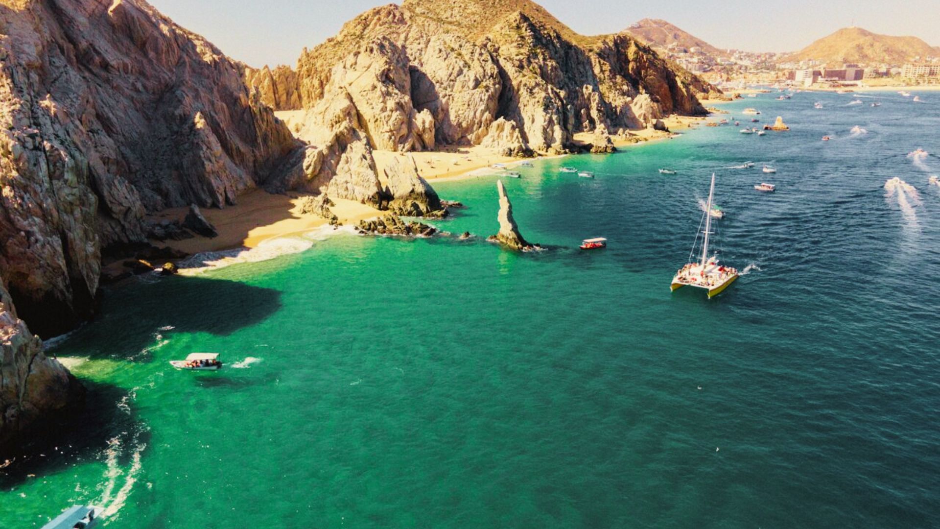
Cabo San Lucas is a city in Baja California Sur, a state in northwestern Mexico. It sits at the very southern tip of the Baja California Peninsula.
This long, narrow strip of land stretches about 1,200 kilometers down from the US-Mexico border.
What makes this spot stand out is its position. The city faces the Pacific Ocean on one side and the Sea of Cortez on the other. Very few places in the world sit exactly where two major bodies of water meet.
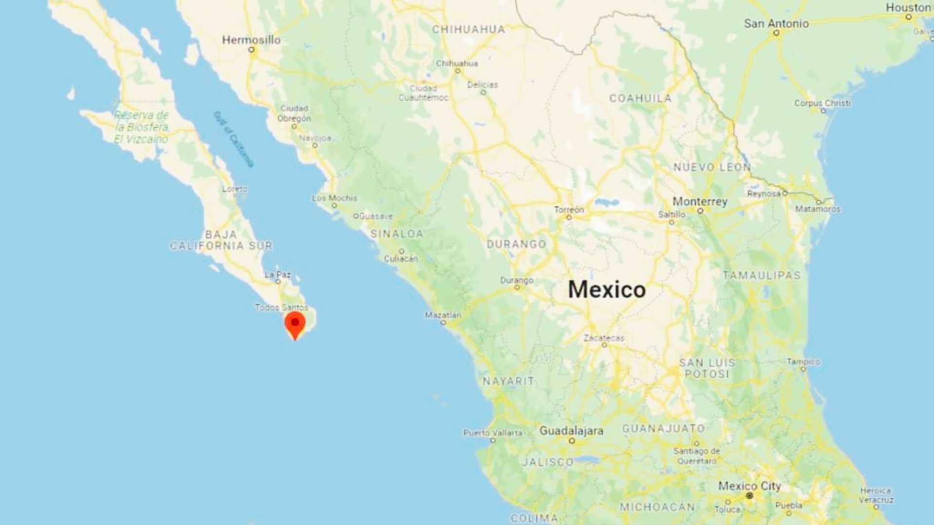
If you look at a map, the Baja Peninsula looks like a long finger pointing south. Cabo sits right at the tip.
Cabo Location on the Map
Knowing where Cabo sits on a map helps you plan smarter, whether you are booking a hotel or planning a day trip.
Cabo San Lucas on World Map
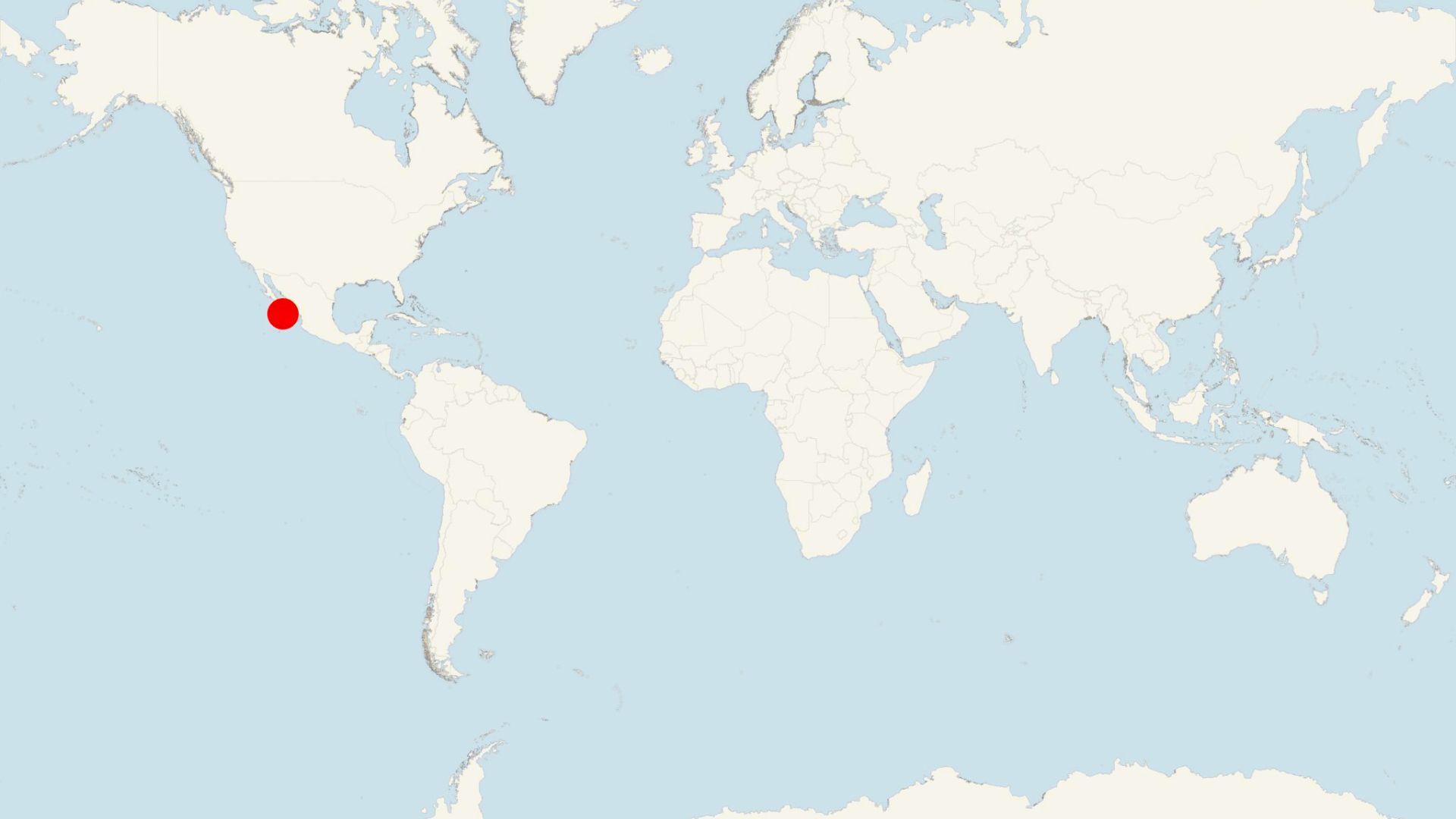
Cabo San Lucas sits in North America, just south of the United States. It is directly below California.
The Baja Peninsula looks like a long finger pointing south on the map, and Cabo sits right at the tip of it.
Cabo Location on Mexico Map

On the Mexico map, Cabo is on the western side of the country. The Baja Peninsula is separated from mainland Mexico by the Sea of Cortez.
This gives Cabo a very different feel compared to destinations like Cancun or Puerto Vallarta.
Cabo San Lucas Coordinates

The exact coordinates are:
Latitude: 22.8905° N
Longitude:109.9167° W
These place it just above the Tropic of Cancer. Use these in Google Maps to check distance from your location or plan water-based tours.
Understanding Los Cabos Region
Los Cabos is not just a place name. It is a region that includes two separate cities connected by a coastal road.
Cabo San Lucas vs San José del Cabo
San José del Cabo is older and more traditional. It has a colonial town center, art galleries, local restaurants, and a quieter pace. It is also where the main airport sits.
Cabo San Lucas is more commercial. It has the famous arch, a busy marina, large resorts, nightlife, and water sports. Most first-time visitors spend the bulk of their time here.
What Is Los Cabos?
Los Cabos is the combined municipality covering both Cabo San Lucas and San José del Cabo. When airlines or hotels say "Los Cabos," they mean the full region, much like a metro area covering two cities.
The Tourist Corridor Explained
The Tourist Corridor is a 33-kilometer coastal stretch between the two cities. It is lined with luxury resorts, golf courses, and private beaches. Most large resort properties are here, not in either city center.
Geography of Cabo Location
Cabo's geography is shaped by two oceans, desert land, and dramatic rock formations that took millions of years to form.
Where the Pacific Ocean Meets the Sea of Cortez
The Pacific Ocean sits on the western side. It brings stronger waves and cooler water, making it less suitable for swimming.
The Sea of Cortez is on the eastern side. It is calmer, warmer, and ideal for snorkeling and swimming. This meeting point creates a mix of currents and marine life found in very few places on Earth.
Land's End and The Arch
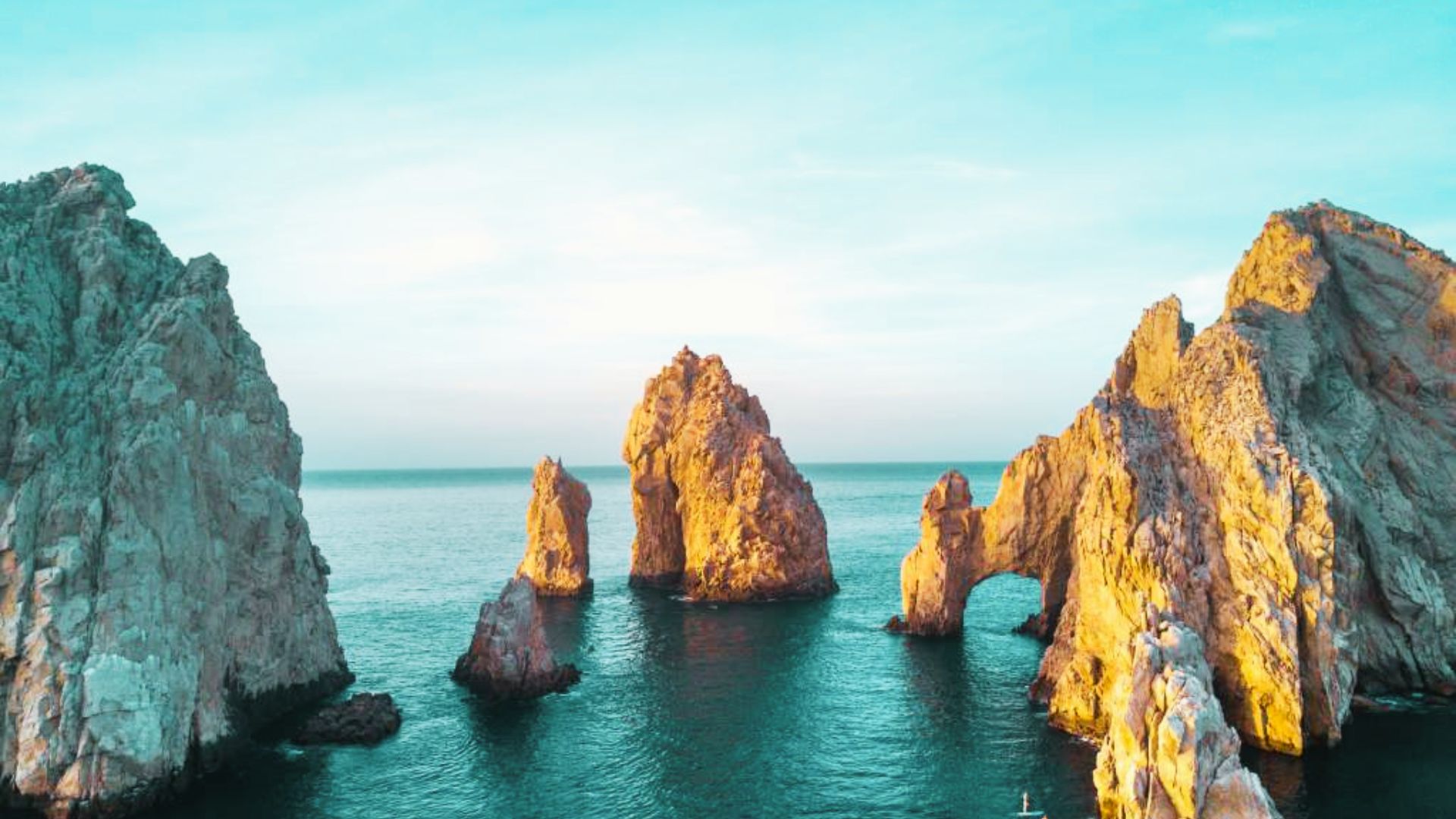
At the very tip of Cabo sits Land's End, where the land physically ends. Here stands El Arco, a natural granite rock arch formed through centuries of wind and water erosion.
It is only reachable by boat and is the most recognized image of Cabo.
Climate and Landscape Features
Cabo is mostly desert meeting the ocean. The climate is warm and sunny year-round. Temperatures range from 24°C to 35°C in summer and stay above 18°C in winter.
The short rainy season runs from late August through October.
Why Cabo's Location Is So Special
Alt Text:La Isla Tour boat cruises near golden sunset at El Arco, iconic rock arch in Cabo San Lucas.
The geography here is not just beautiful to look at. It creates real conditions that make Cabo one of the top coastal destinations on the planet.
Marine Life and Ocean Currents
The mixing of Pacific and Sea of Cortez currents creates a rich marine environment. It supports whale sharks, manta rays, dolphins, sea turtles, and hundreds of fish species.
Jacques Cousteau reportedly called the Sea of Cortez "the world's aquarium," and Cabo sits right at its entrance.
Sportfishing and Water Activities
Cabo is globally recognized as one of the best sportfishing spots. Ocean currents bring marlin, tuna, and dorado close to shore.
Beyond fishing, the location supports snorkeling, diving, whale watching, kayaking, and surfing on the Pacific side.
Scenic Beauty and Tourism Appeal
Desert cliffs, golden beaches, blue water, and rock formations create a setting that is hard to match. Lover's Beach sits on the calm Sea of Cortez side.
Divorce Beach is right next to it, facing the rough Pacific. Both are in the same small area, which sums up what makes Cabo so interesting.
Tips to Understand Cabo Location Easily
A little planning goes a long way when you know how Cabo is laid out.
- Look at a map of the Baja Peninsula before booking so you know where your hotel sits relative to the airport, beaches, and marina.
- Decide between Cabo San Lucas (lively, marina-focused) or San José del Cabo (quieter, cultural) before choosing accommodation.
- Check if your resort is in the Tourist Corridor, as it requires a drive to reach either city.
- Note that the Pacific side has stronger waves, while the Sea of Cortez side is calmer for swimming.
- Use the coordinates (22.8905° N, 109.9167° W) in Google Maps to check distance from your home city.
Conclusion
I remember looking at a map before my first Cabo trip and thinking, "It is right at the very tip?"
Realizing it sits between two oceans, on the edge of a desert peninsula, made the whole experience feel more meaningful.
Cabo's location is not just geography. It is what makes everything here possible, from the marine life to the weather to the views.
If this guide helped you understand Cabo San Lucas better, share it with someone planning their trip. Drop your questions in the comments below.
Frequently Asked Questions
Where exactly is Cabo San Lucas located?
Cabo San Lucas is at the southern tip of the Baja California Peninsula in Baja California Sur, Mexico. It sits where the Pacific Ocean and the Sea of Cortez meet.
Is Cabo in the Pacific Ocean or Sea of Cortez?
Cabo sits at the point where both meet. The Pacific side has rougher water, while the Sea of Cortez side is calmer and better for swimming and water activities.
What is the difference between Cabo and Los Cabos?
Cabo San Lucas is a specific city known for its marina and nightlife. Los Cabos is the larger region covering both Cabo San Lucas and San José del Cabo, along with the Tourist Corridor between them.
How far is Cabo from the United States?
From Los Angeles, Cabo is roughly 1,850 kilometers by road or about a 2 to 2.5 hour flight. From the US-Mexico border at Tijuana, it is about 1,750 kilometers by road.
Can you drive to Cabo San Lucas?
Yes, via Federal Highway 1 from Tijuana. The road is mostly paved, but the trip takes several days and passes through remote areas, so planning fuel and water stops in advance is important.
